|
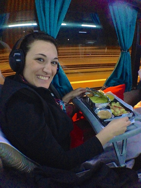
With our South American adventure sadly coming to a close in November, we also reached our first of many milestone dates….. six months on the road! This got us thinking. We keep track of so many facts and figures during our travels that we thought it would be worth sharing some of them for anyone who's interested. So here it is, a brief compilation of a few fun and interesting trip statistics, facts and figures from our first six months of this indefinite adventure! Enjoy!
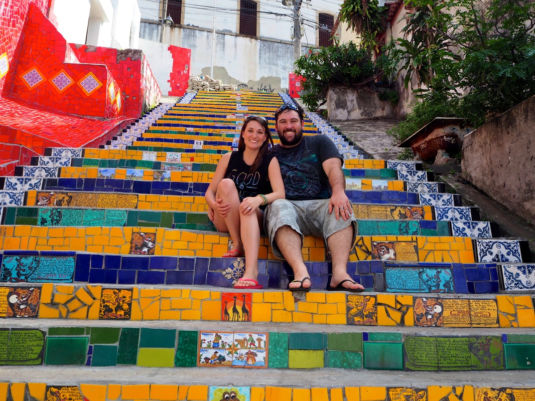
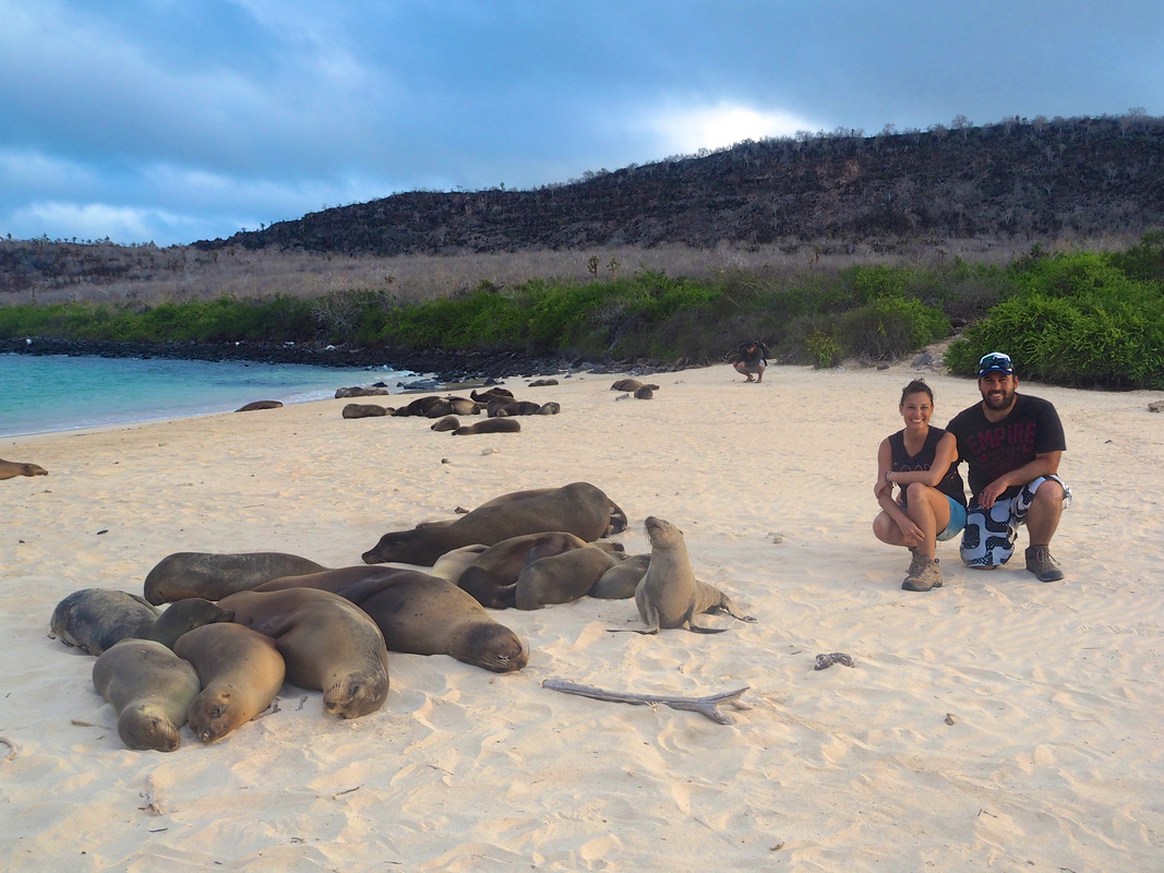
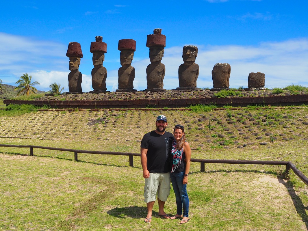
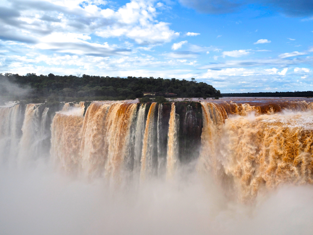
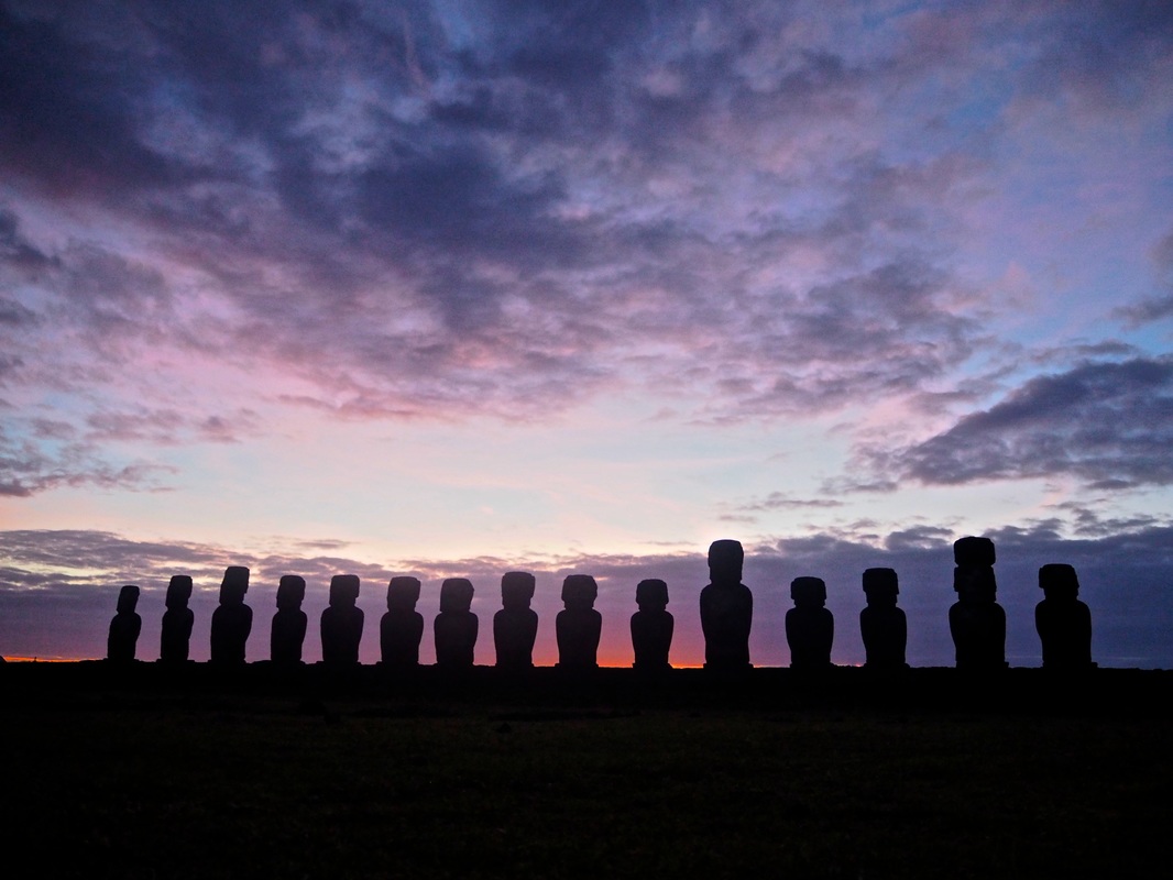
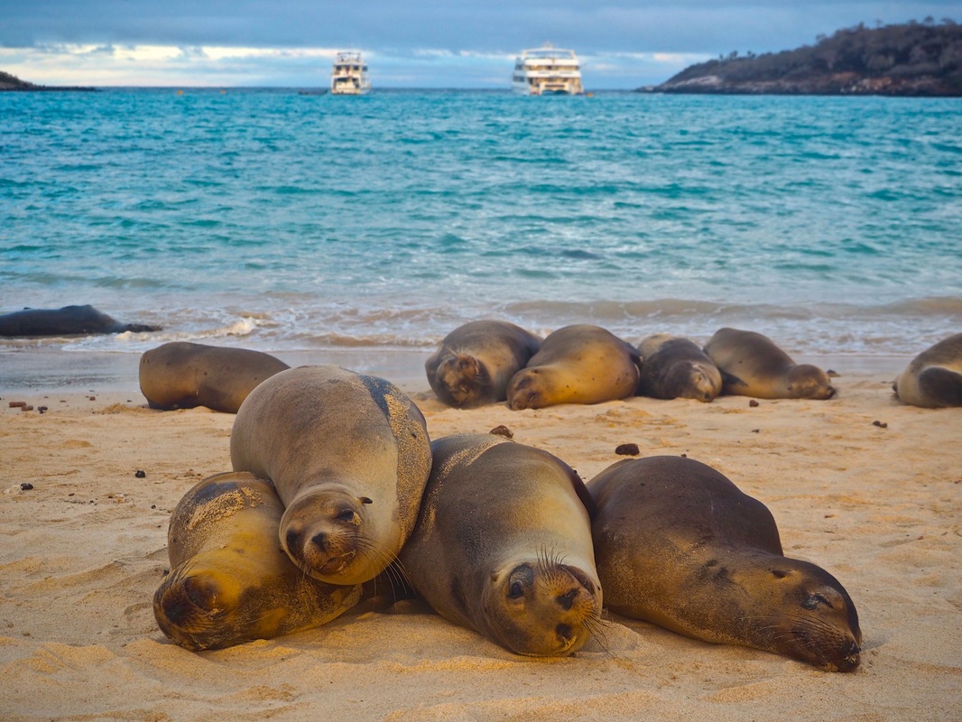
Overall Favourite Destinations = Galapagos Islands and Easter Island (Rapa Nui) (Click the photos below to see our complete Photo Albums from these mind-blowingly awesome destinations!)
Facts:We visited the......
Stay tuned to www.wadeandsarah.com for more Stats, Facts and Figures blogs as we continue our travels around the World! 
1 Comment
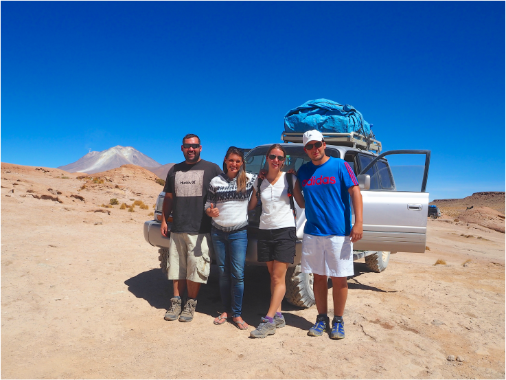
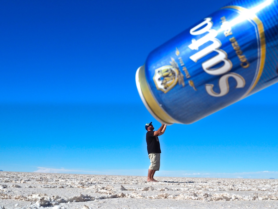
Where possible, we generally tend to avoid traveling on organized tours. It's not that we've had bad experiences or that we are against the idea, but most of the time we just prefer to do our own thing. This way we can stay in a place for as long or short as we like, do the activities we really want to do and choose accommodation that suits our wants and needs. We also find that once we weigh up the cost of organized tours, it often isn't worth the money considering we actually enjoy living by the seat of our pants and making our travel plans as we go. There are however, times when tours not only make traveling easier, but sometimes there really isn't any option other than to book through a travel agent in order to get to the places you want to see. Salar de Uyuni, the salt flats in Bolivia, is one such place where we decided that a tour really was our only option. Our goal was to cross the salt flats of Bolivia, into the Atacama Desert where we would cross the border into northern Chile finally reaching the town of San Pedro de Atacama. Without a car and with no clear roads through the salt flats or the desert, (which is considered the driest place on Earth) it was fairly obvious that this was one of those occasions when a tour was without a doubt, our only option. 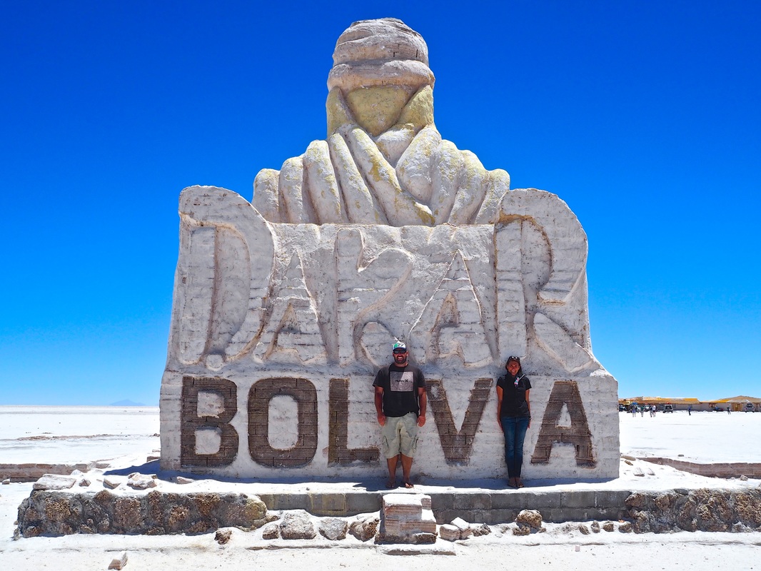 Photo: This sculpture was created for the Dakar rally. While it has an inner support of bricks, it is coated in a thick layer of salt from the endless supply in Salar de Uyuni After speaking to other travelers we were told that most companies offer two options for the tour. Being that English is not particularly widely spoken in Bolivia, most tours are run by non-English speaking drivers, however for considerably more money you can find a company offering English-speaking drivers. Feeling a little over confident with our terrible Spanish, we opted for the non-English speaking driver. We had been told that the drivers don’t particularly run a “tour” as much as simply driving from point A to point B and besides we figured it would be a good opportunity to practice our Spanish…… Ha! Upon jumping into our 4wd we were greeted by another couple who barely spoke a word of English and had absolutely no interest in putting up with our terrible Spanish, therefore killing all possible conversation. At this rate, it was gonna be a long 3 days! There were 2 more seats in the car and suddenly we began to worry that we were in for a pretty silent journey seeing as the last two passengers were also listed on the driver’s paperwork as Spanish speakers. Next stop and in jumped Alvaro and Monica. We tentatively introduced ourselves trying to suss out whether or not they spoke English. Little did we realize this couple from Switzerland, speak more languages than we’d had hot showers in the past month! (sadly, yes this is a true fact!) They are both fluent in Spanish, French and English along with some Portuguese and Italian! Basing our feelings purely on this information, we HATED them! Our feelings of inadequacy were only increased by the fact that they are also bloody awesome people and completely made our 3 day trip yet another excellent experience. Yep, total arseholes!
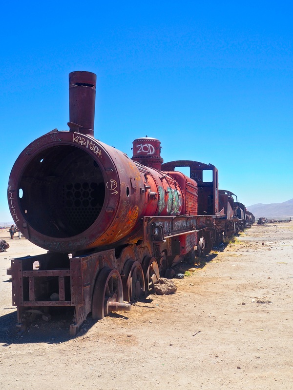
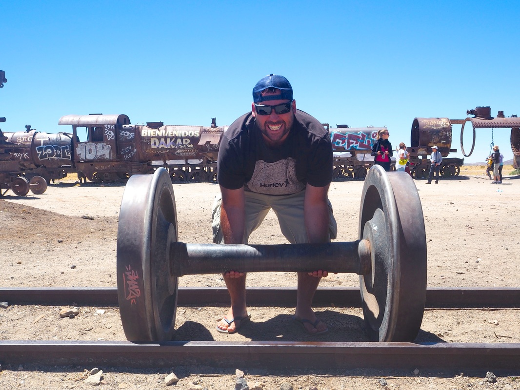
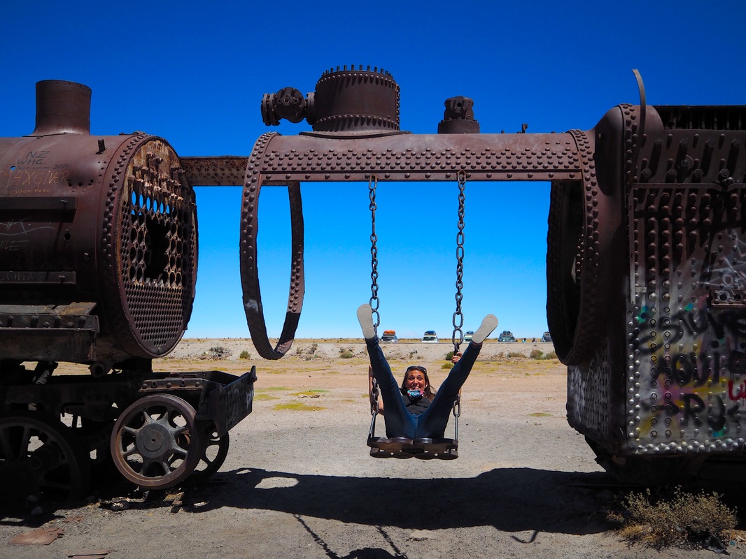
Photo: Meeting Alvaro and Monica made our trip a million times better. In fact we then went on to spend 2 more days with them in San Pedro and recently met up with them again in Thailand! Upon leaving the town of Uyuni, we headed straight to the Train Cemetery. The Train Cemetery is a bit of a gimmick once you see that its actually just a dumping ground for old trains, cars and other bits and pieces however the rusty old skeletons of trains surrounded by clear blue skies and barren mountains far off in the distance, make for some excellent photo opportunities. In walk 50 tourists. For some ridiculous reason, all tours departing the small town of Uyuni, begin at exactly the same time and all make their first stop at the Train Cemetery. This would have been fine, but my dear husband Wade generally just doesn’t like people, so within minutes of getting out of the car he was pouting like a little girl and making loud sighing noises every time someone walked through his photos. I found the whole scenario rather amusing but the more I told him to get over it, the angrier he became. We were still able to snap some cool photos and climb through the old wrecks of the trains though so all in all, still an interesting first stop.
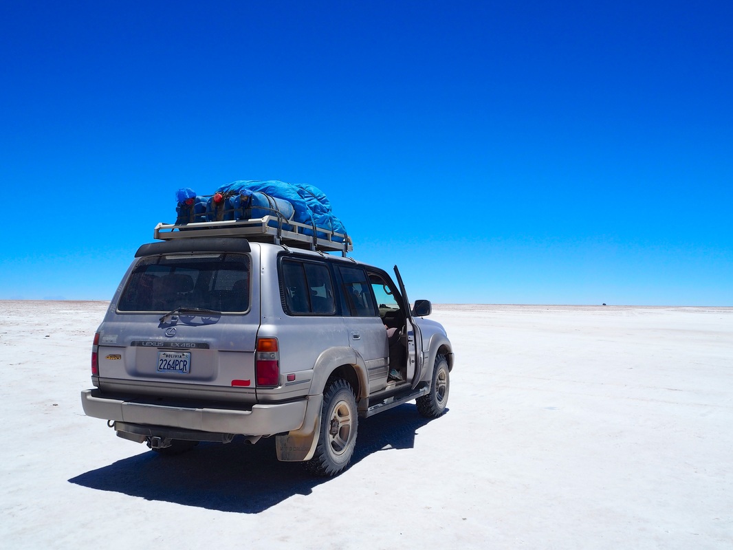
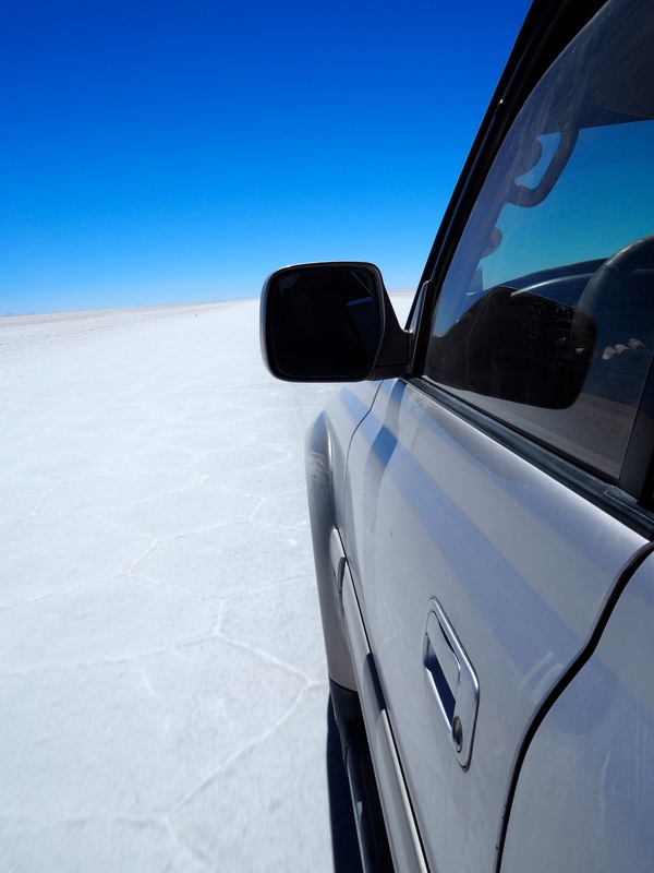
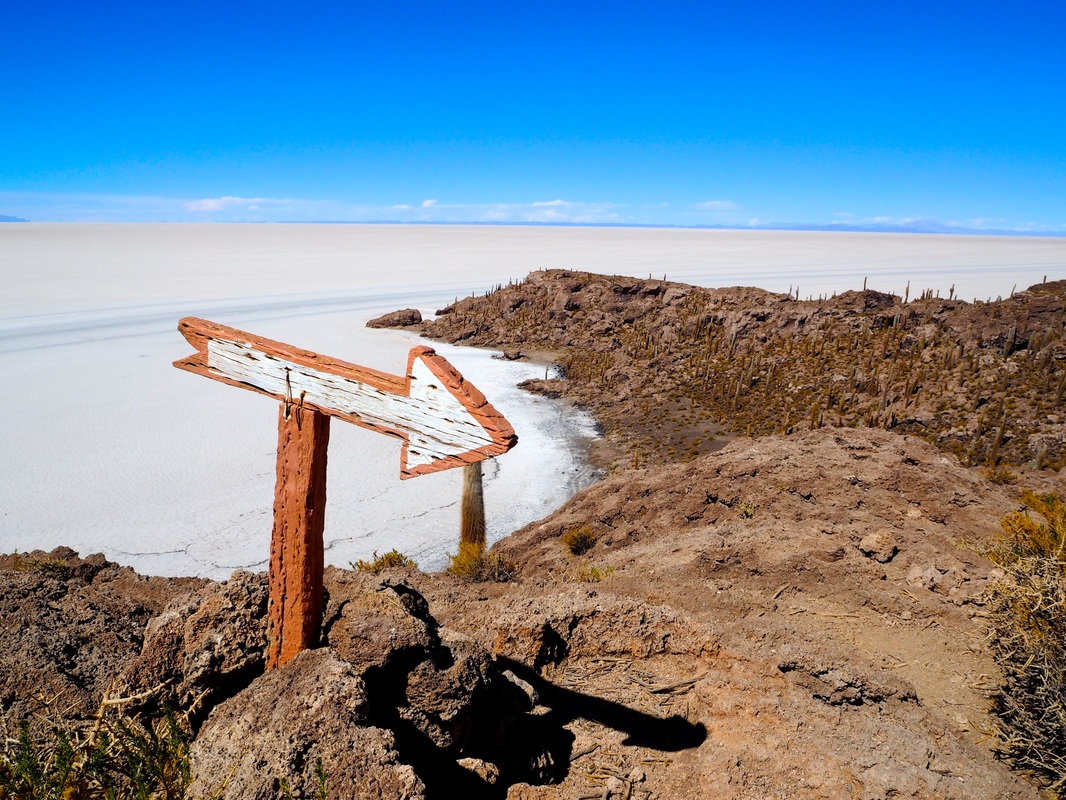
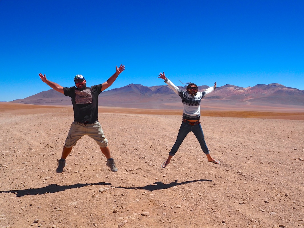
As we tore off in a cloud of dust from the Train Cemetery, we once again unwillingly joined the convoy of 4wd’s cruising across this great open space. We started to worry that the next few days would be just one big convoy, with each car stopping at identical locations on a fixed itinerary. However, the further we drove, the more apparent it became that with such a vast landscape and no signs or roads visible to the untrained eye, a single degree of difference in direction would send two vehicles on completely different paths and within an hour, we had all but lost every other sign of human life. It's almost dream-like when you finally reach the world renowned Salt Flats. The horizon becomes a hazy blur and everywhere you look is a sheet of white. The glare from the sun reflecting off the pure white expanse beneath us makes it almost impossible to look at without sunglasses. The salt crunches under your feet as you walk and yet it is rock hard to touch. All sense of perspective is lost and it is only upon scanning 360 degrees that we can see the faint hue of mountains on the horizon East of us. The "road" is merely a set of tyre tracks that our driver sporadically switches between sticking to and creating his own path.
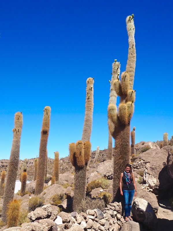
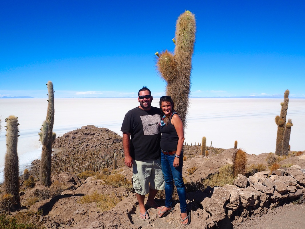
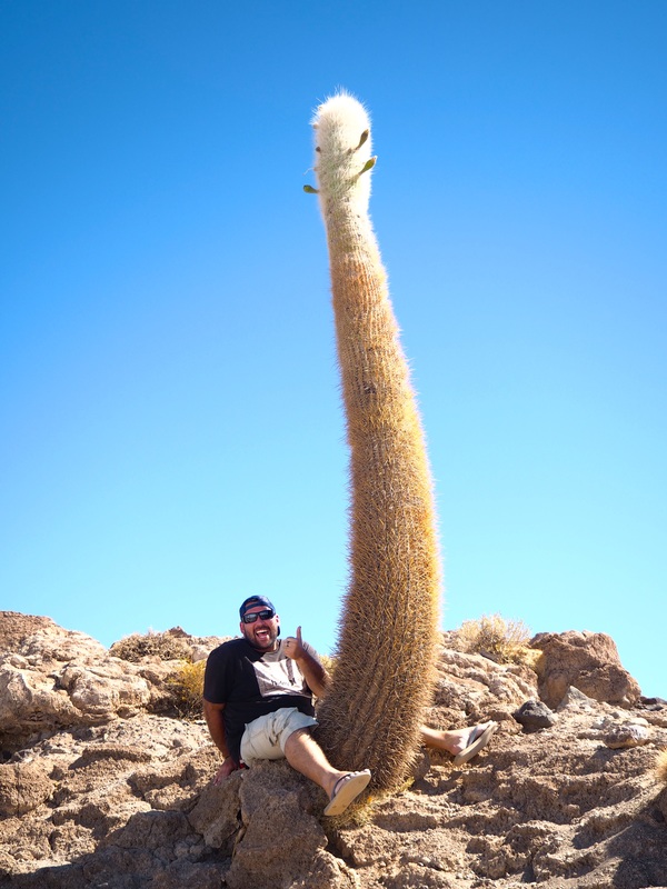
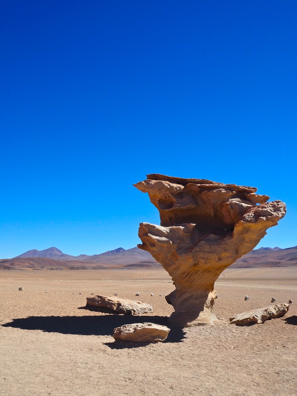
Once the car comes to a halt another of Mother natures incredible works of art becomes apparent. The salty earth is patterned with large hexagons side by side like tiles as far as the eye can see. The edges are defined by a ridge of salt so straight and perfect that one struggles to believe that this is the work of nature rather than a team of labourers with long rulers! It's magnificent, thought provoking and mysterious. It blew my mind and confused the hell out of me all at once. I loved it! Now look I’m no scientist and most of you probably don’t care why this happens so rather than me regurgitating someone else’s explanation, lets just appreciate this phenomenon for the natural, marvelous occurrence that it is. 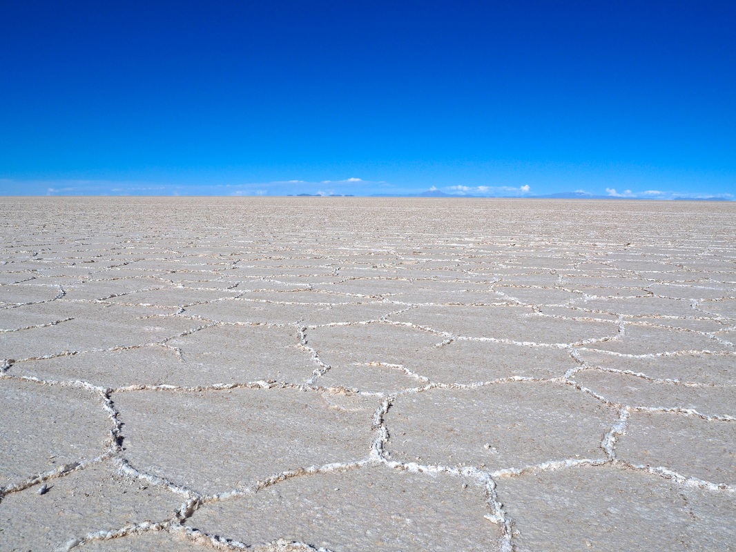 Photo: The hexagonal pattern across Salar de Uyuni becomes a white blur when speeding past, but once you stop, you can truly appreciate this natural wonder Just when we thought our driver had joined the rest of us in a state of complete disorientation, an island began to appear in front of us. No, this was not the first stage of insanity, the closer we drove, the clearer this cactus-covered island became. Isla Incahuasi as it is known is an ancient island of fossilised coral. The cacti that sit upon it like pins in a pin cushion are up to 1000 years old and stand some 9-10 metres tall. I was suddenly grateful for the lack of a chatty English-speaking guide as this adventure was surprising me at every turn. We had no idea this place even existed! We spent an hour clambering over lose rocks and stone paths, squinting and craning our necks to see the top of some of the worlds tallest cacti. We took the obligatory cactus-penis photos, stood in awe of the view at the top and then made our way back down to the car for some much needed shelter from the unrelenting sun.
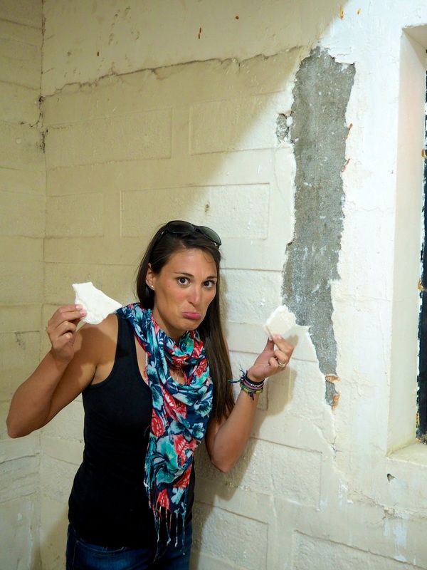
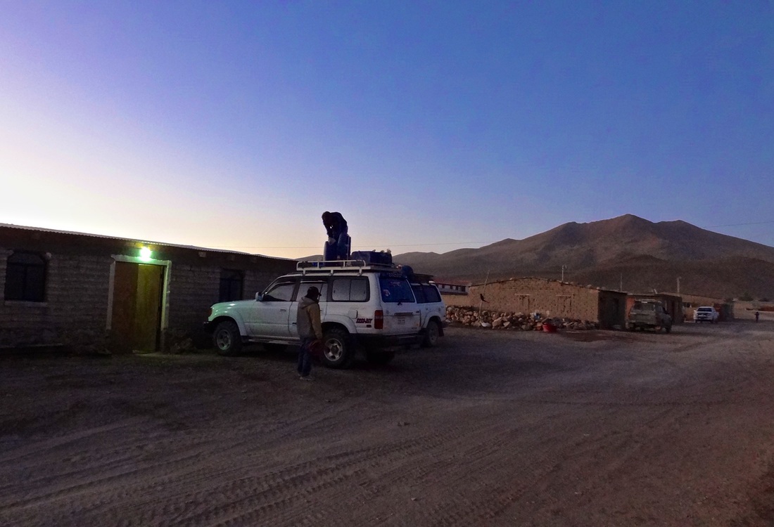
Photo: Isla Incahuasi (sometimes also known as Isla del Pescado) is covered in some of the tallest cacti in the world, making for incredible views and also providing the perfect opportunity for a cactus-penis photo! As the sun began to set, we were once again driving along a non-existent track to an unknown destination. It turned out that this time our driver was in the same boat as us. The tour company doesn’t actually make bookings for our accommodation, as small “Salt Hotels” are scattered throughout the region so it is merely a matter of showing up and asking for a few beds. Three hotels down and no luck, the six of us began to joke nervously as we all hoped we wouldn’t be sleeping in the same car we had spent most of the day. Finally, our guide came back to the car with a smile, he had scored us three rooms in a real “Salt Hotel” for the night! By the time we checked in, we didn’t even care that the walls were crumbling and revealing that it was in fact just a brick building coated in salt to please the tourists!
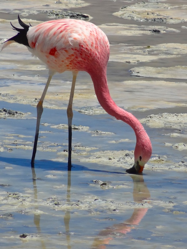
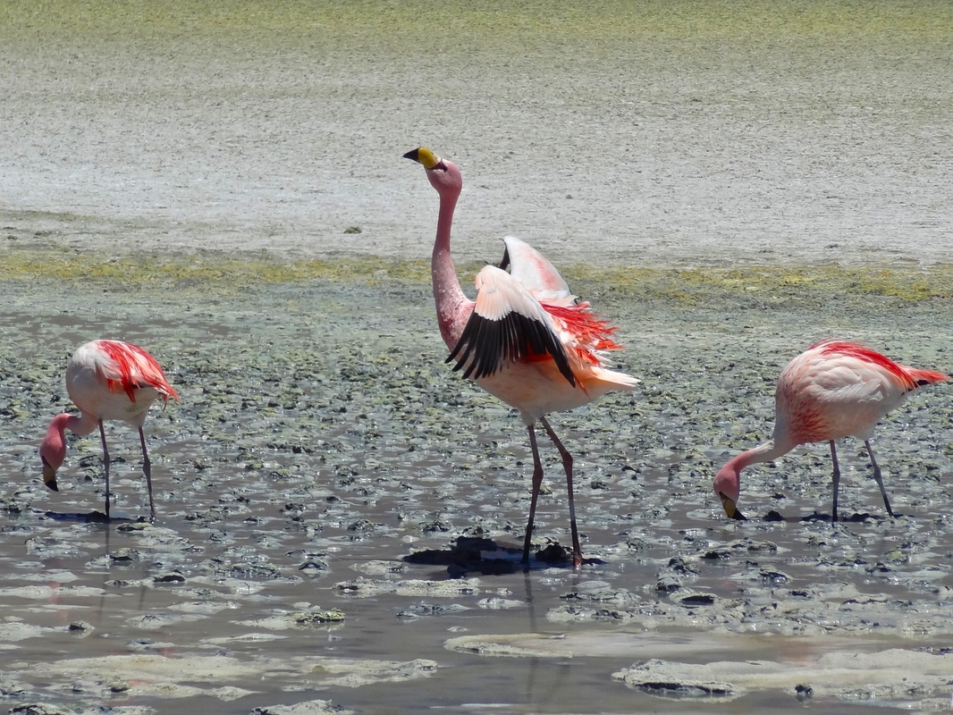
Photo: So much for a "Salt Hotel"! Even though the floors, walls and ceiling were coated in salt, the chunks crumbling off our wall revealed that it was simply a coating and not entirely built from salt bricks as some places in Salar de Uyuni are Morning broke on our second day and it was damn cold! As we took our places in the car, we noticed that the scenery had changed significantly. No longer were we surrounded by the blinding white of the Salt Flats, instead it was now a harsh and dusty scene created from an entirely brown colour palette. There was suddenly an excess of dust and jagged mountains and a serious lack of anything living. Our driver had promised beautiful lagoons today, but watching the landscape rush by outside the car, I wasn’t convinced this place had ever seen life or water for that matter. I’m not gonna lie, after half an hour of driving through presumably never-ending desert, I closed my eyes and slept solidly for the next two hours. If the scenery did change during this time, I was none the wiser, but judging by the blank stare on Monica’s face when I woke up dribbling on her shoulder, I’m pretty confident I didn’t miss anything. Well, other than our friendship reaching that “dribble on the shoulder” level. We stopped for a short break with incredible views over a distant volcano before piling back into the car, fearful that being forgotten out here was a guaranteed recipe for death. 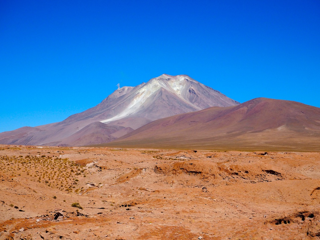 Upon finally arriving at the first lagoon, Laguna Hedionda, my only thought was stretching my aching body and getting some fresh air. Fresh air was hit-and-miss, as the Spanish translation for the lagoon is “Stinking Lake”, however as soon as I was standing next to our now very dusty chariot, I was mesmerized by the view before me. Hundreds, if not thousands, of flamingos danced gracefully amongst their own reflections in the still, glassy water. Across the other side of the lagoon it was impossible to make out the shapes of the flamingos and yet the pink hue glowing across the surface in the distance was proof enough of their presence.
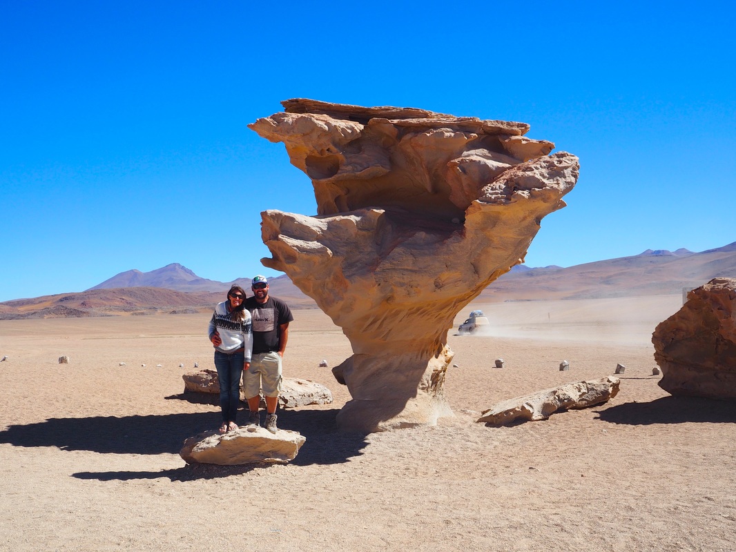
Photo: Flamingos on Laguna Hedionda I watched them from the edge of the lagoon, fighting to hold myself back from walking beyond the "do not pass" sign. Their beauty and grace astounds me as such a lanky and disproportioned creature can somehow still embody elegance. After a quick lunch that our driver magically whipped up in the back of our 4wd, we took the opportunity to walk ahead while our driver finished packing the car. As we turned to check whether our driver was coming to collect us, an awesome tunnel of wind formed right before our eyes. This apparently lifeless landscape had more surprises than I ever could have imagined. 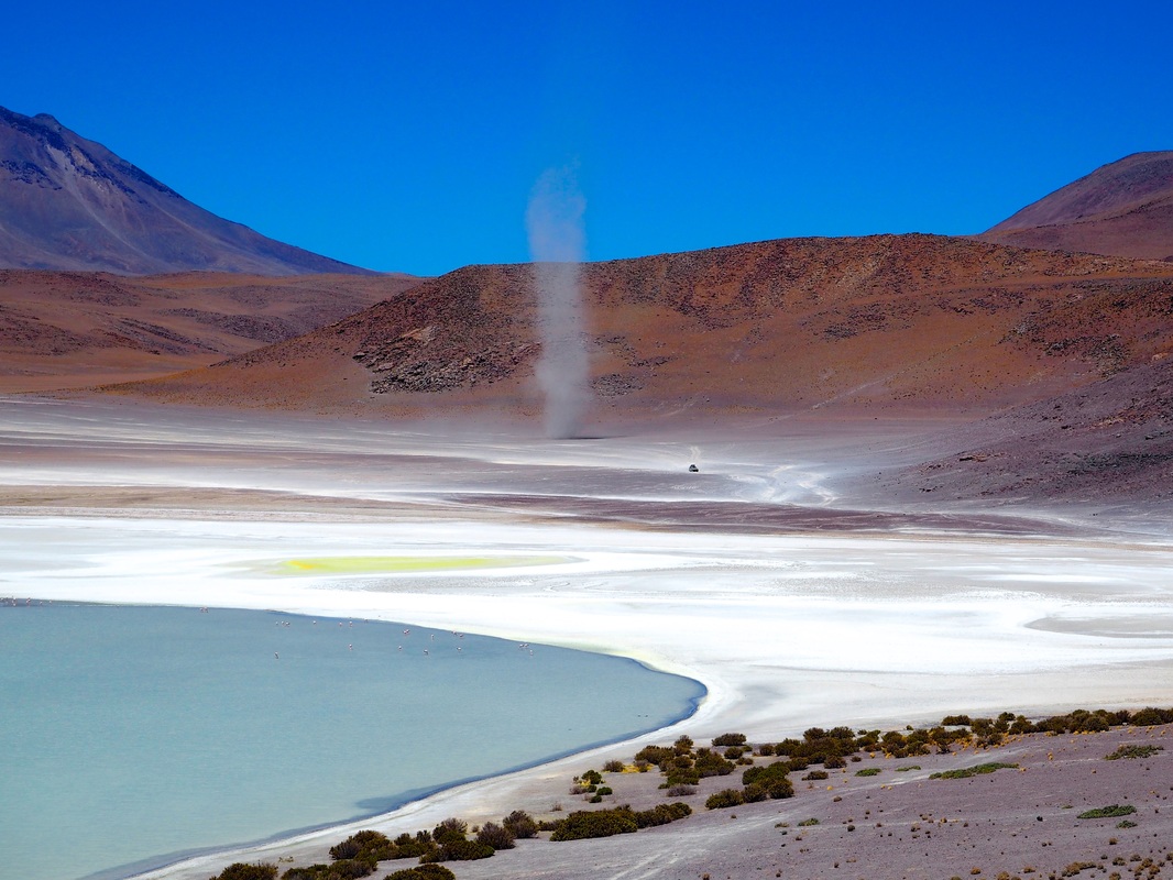 Photo: Whirly wind being whipped up from the dust as our driver comes to collect us at Laguna Hedionda Within minutes we were back in the car, and once again surrounded by barren rust-colored mountains. If you didn't know Laguna Hedionda was there you would've driven straight passed it and been none the wiser. The scenery was mesmerizing and yet apparently so mesmerizing that after another hour in the car I was once again asleep on Monica's shoulder. If we weren't friends before, we sure were now! Our final (and slightly gimmicky) break for the day was at a rock formation known as “Arbol de Piedra” or stone tree which has been created by centuries of howling, sandy winds whipping past and grinding the stone into a rough tree shape.
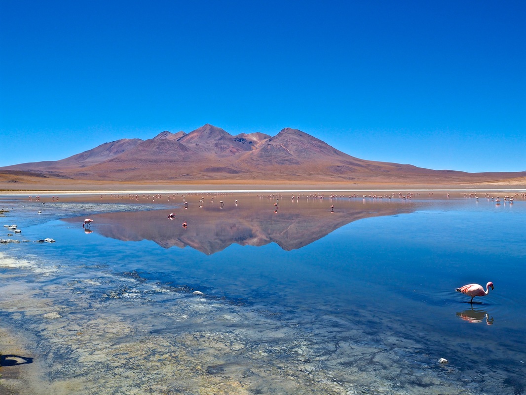
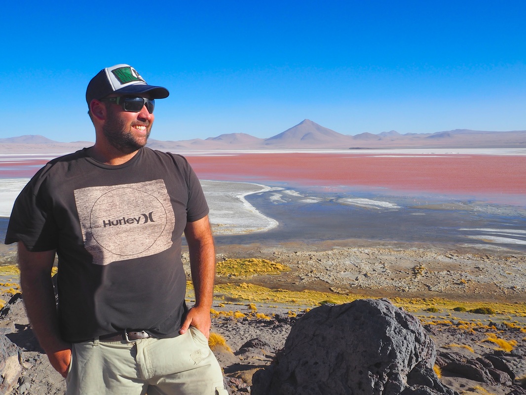
When we pulled up to our accommodation for the night and stepped out of the car, the wind pierced through every layer of our clothes. The 4300m altitude was now apparent through our strained breathing and the freezing air. But man was it worth it! Our destination, Laguna Colorado, was laid out before us like a painting. The red glow of the lagoon had to be seen to be believed and when we reached the viewpoint, we once again sat in awe of the magnificent places this adventure has opened our eyes to.
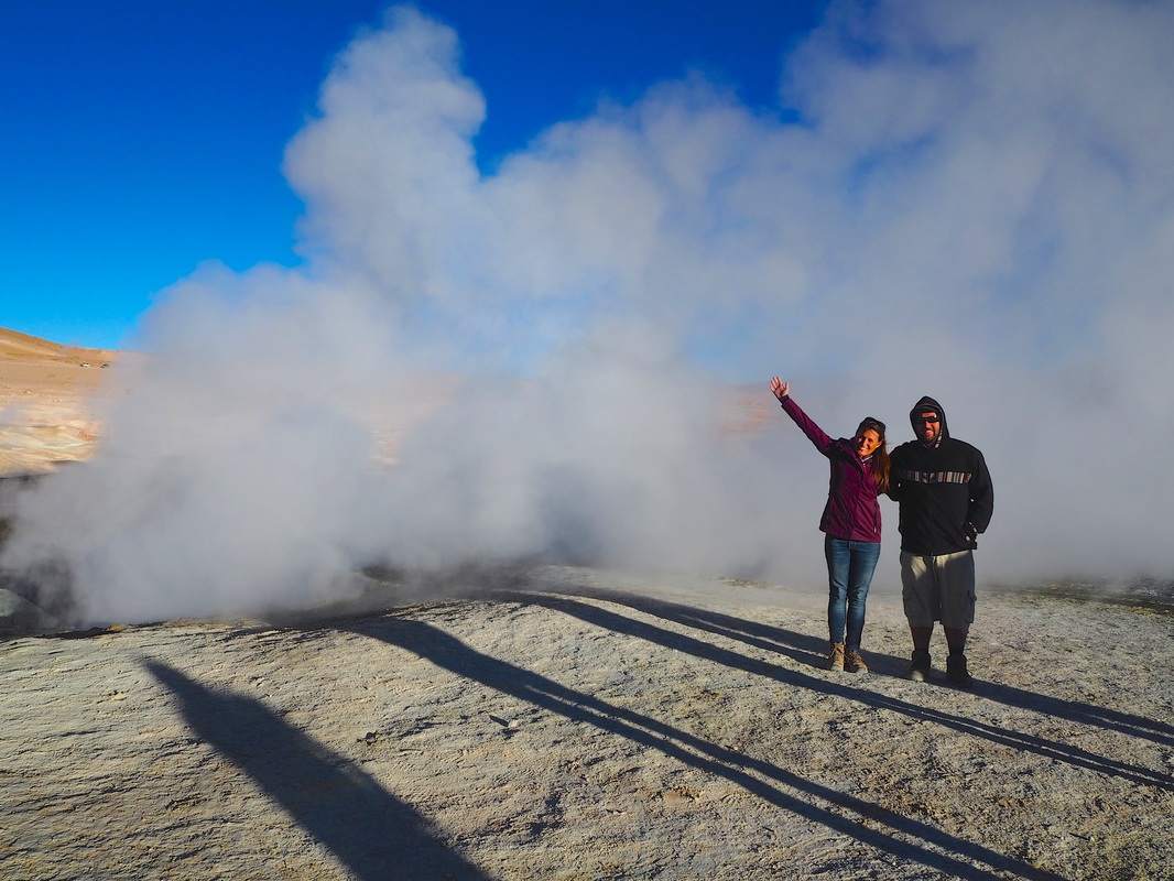
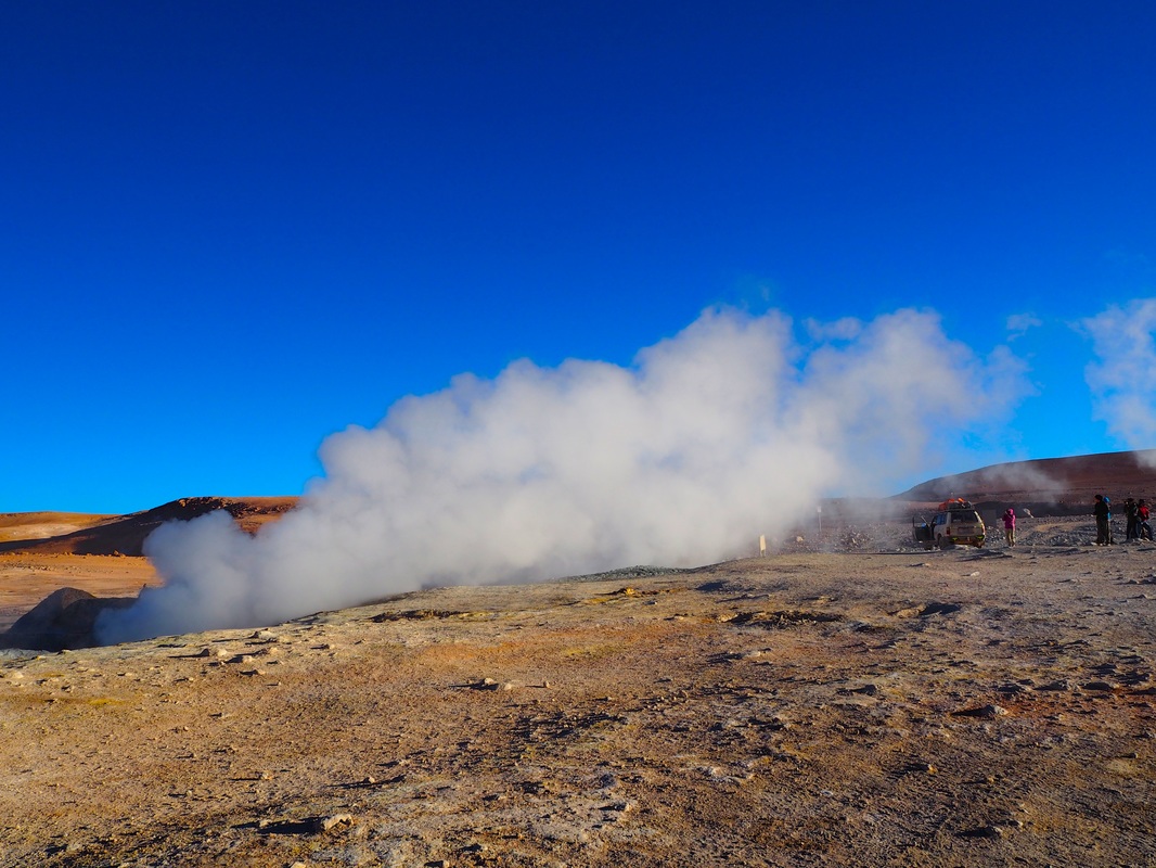
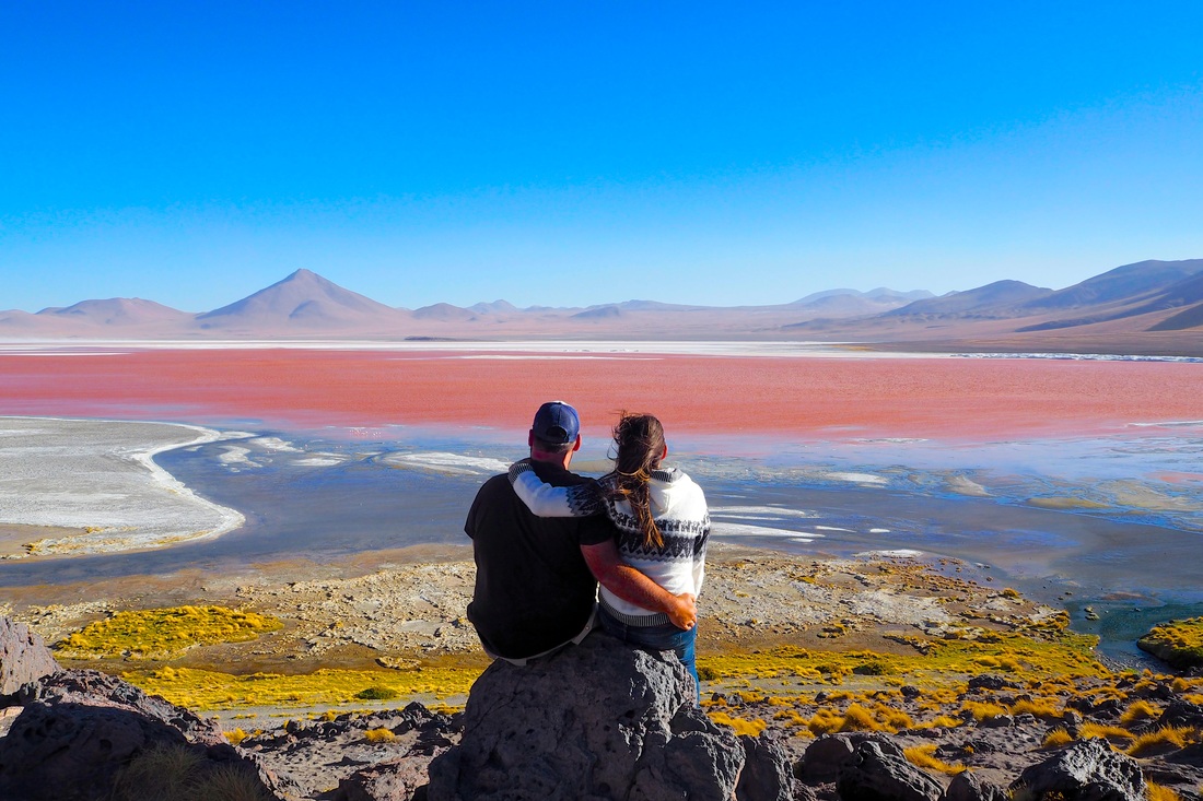 Photo: Simply stunning, Laguna Colorado. The algae gives the lagoon a red glow which apparently changes from blood red to a bright pink hue depending on the season and water levels After a wretchedly ice-cold night in a powerless brick building, we were back in the car before sunrise to continue climbing to a peak altitude of 4800m. When the pungent smell of sulphur began to leak in through the air conditioning and pillars of steam could be seen ahead of us and we knew we had arrived at the geysers. Bubbling up from the ground from deep crevasses in the Earth’s crust was boiling hot, toxic steam. Remembering that this is Bolivia, there are no railings, few signs and every chance of the ground caving in at any moment, it’s quite the experience!
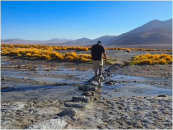
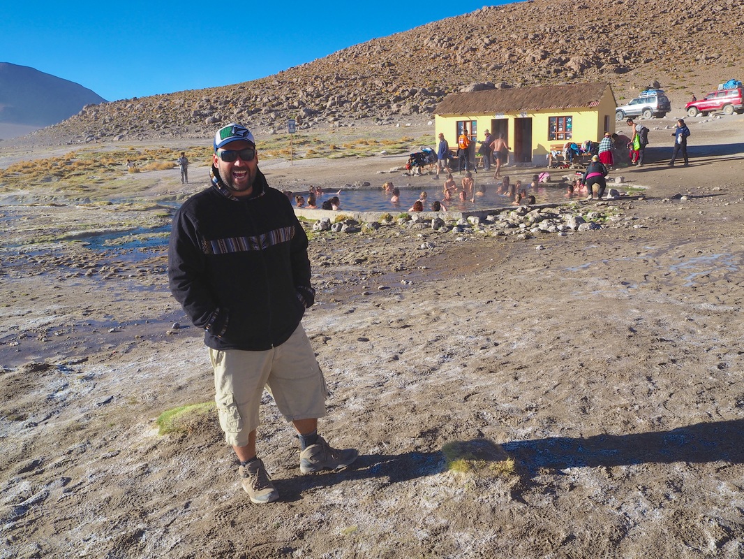
Photo: This photo doesn't do it justice but all around our feet were small holes bubbling with boiling hot water coming up from the Earth's core We could’ve taken a dip in the nearby thermal pool, but something about 30 half naked strangers crowded into a bath-tub sized pool along with the token selfie-stick wielding tourist, said no. Just no. Instead we marveled at the streams running from the hot thermal water into the adjoining lake. The air at this altitude was so cold than within 15 metres of the piping hot thermal pool, the water had once again cooled down and formed a layer of ice across the lake. Such extreme contrasts in such close proximity was yet another nod to the power of ol’ Mother Nature. It also totally justified the 5 layers of clothing I was wearing unbeknownst to my fellow travellers!
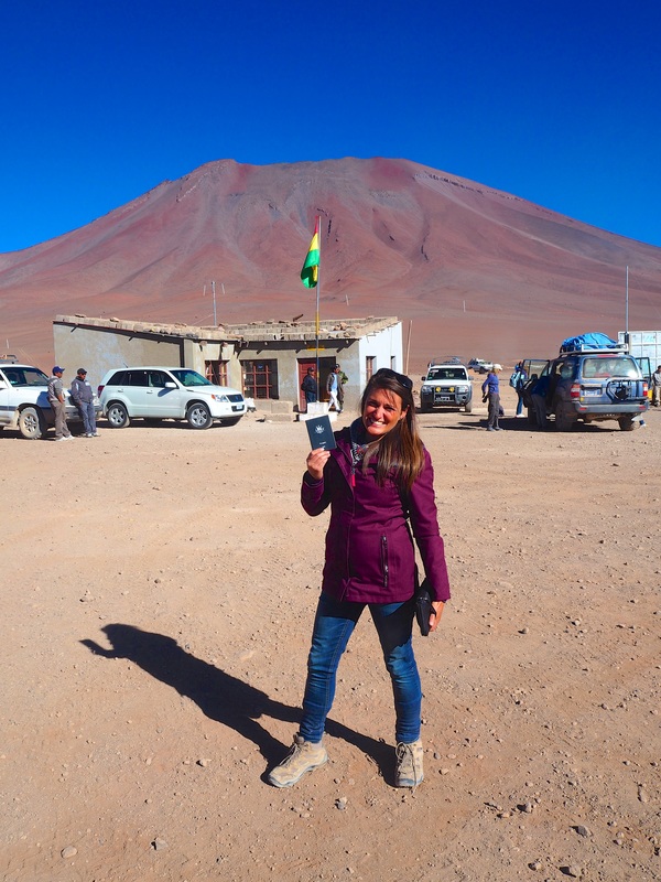
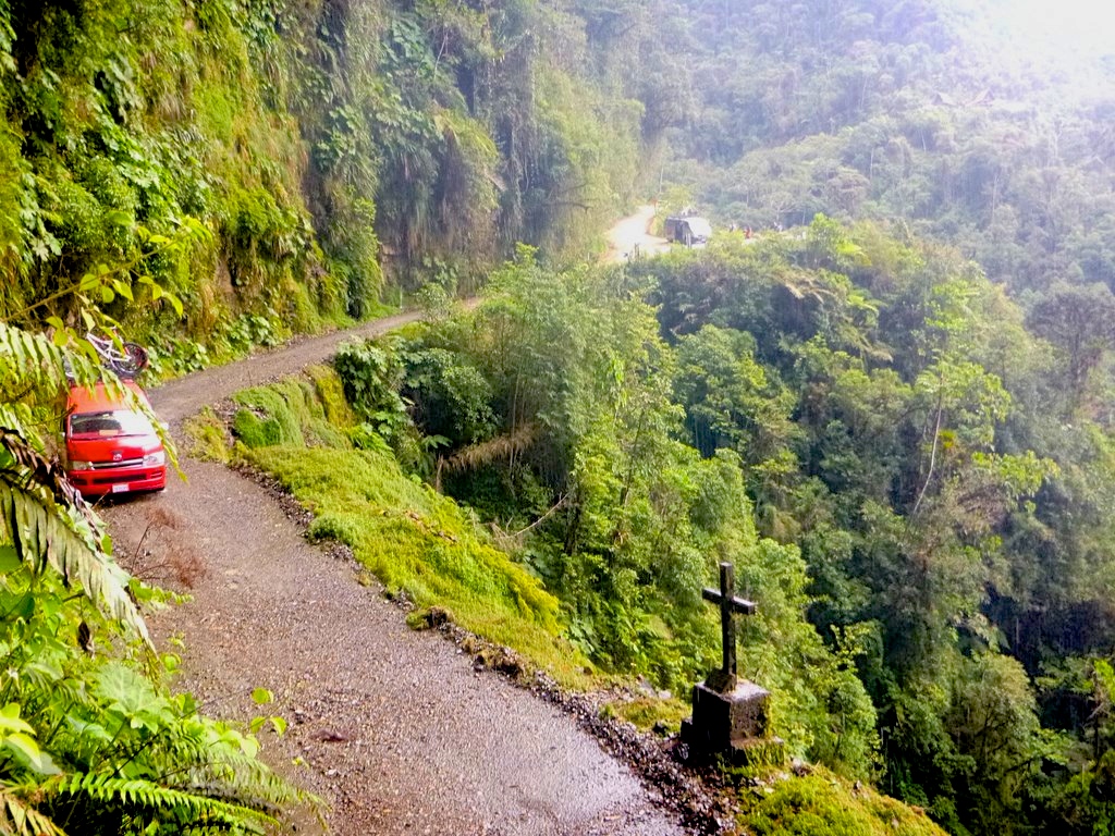
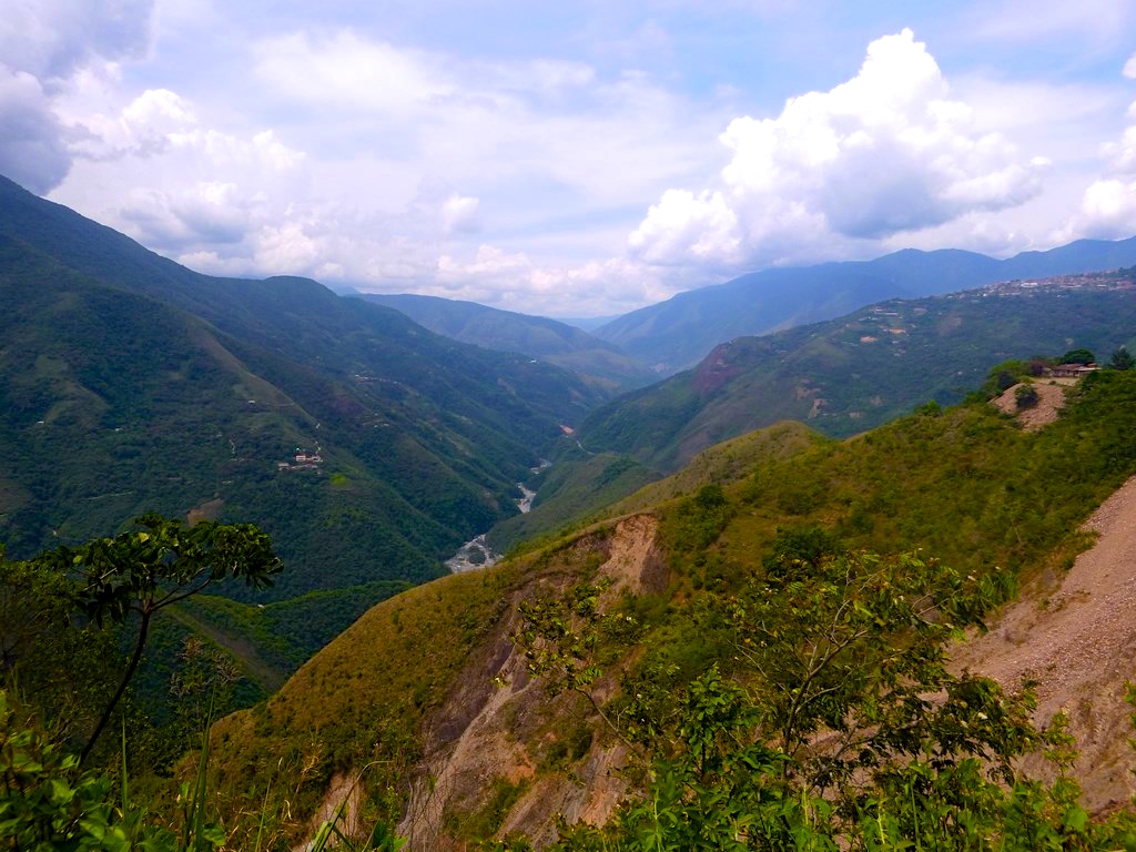
Photo: (Left) Hot tub anyone?? (Right) the water surrounding the thermal pool was freezing within 15 metres of the 40 odd degree thermal pool Our guided tour ended when our driver waved goodbye to us and our belongings, at a non-descript immigration station on the border of Bolivia and Chile. We could only wait and hope that there was some sort of transport from here to San Pedro de Atacama because this was the most rustic set-up we had seen so far in all of our five previous border crossings! We did the obligatory immigration checks, added another stamp to our passports and eventually, a bus did appear out of thin air, to take us across the border into Chile. And just like that, we were back in Chile. The same country where six months earlier this whole crazy journey began and where in 10 days, this incredible South American adventure would come to an end. Little did we know, that in many ways, we had saved the best for last!
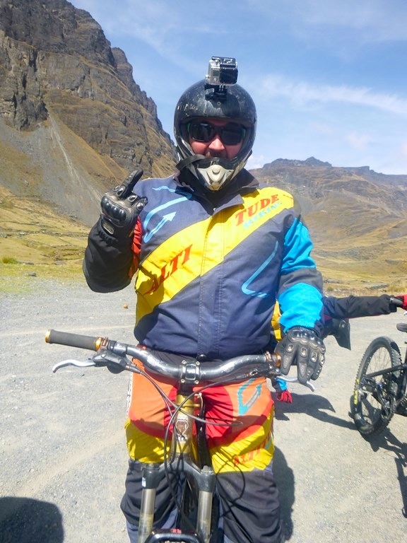
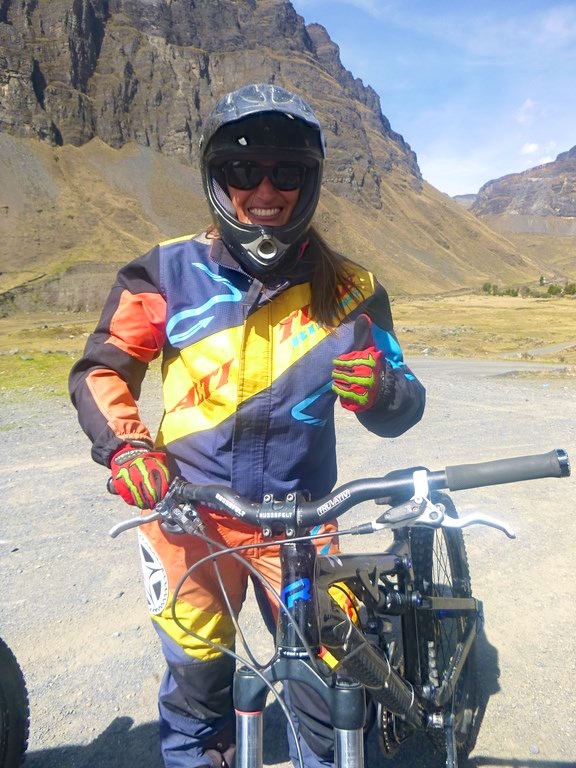
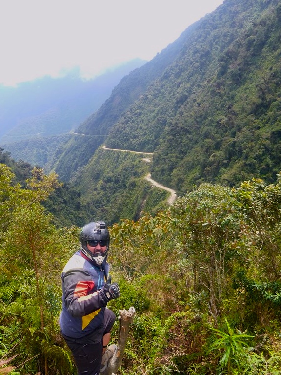
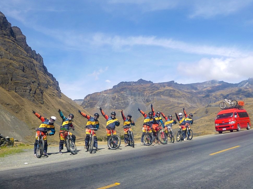
“I Sarah Harris, understand and acknowledge that risks and dangers exist in extreme sports such as this”…. Blah blah blah… “and my participation in this activity may result in injury, permanent disability or death.” Yep, sounds fair to me. Where do I sign? Within minutes of arriving in La Paz, the capital of Bolivia we had barely put our bags down and yet had somehow managed to book onto the aptly named Death Road Mountain Bike Tour without so much as the slightest hesitation. Maybe it was that we had been on a rickety old bus without proper ventilation for 10 hours, or maybe it was just that I’d always said I’d do it and so refused to go back on my word, but one way or another, Wade and I signed our lives away and thus agreed to the above conditions. Plus, if we survive they not only give us a buffet lunch but we also score a free t-shirt, so really I’d say the risk was worth the benefits…. Right?  Photo: La Cumbre, 4700 metres above sea level is the starting point for this dangerous journey Death Road, officially known as the Yungas Road, was the original route connecting La Paz to the Bolivian section of the Amazon jungle. It has been nicknamed Death Road, or Camino De La Muerte in Spanish, after countless deaths during it’s construction and use over the past 70 years. In 1995 it was listed by the Inter-American Development Bank as the Worlds most dangerous road and more recently it has been closed the vast majority of traffic with safer roads now available for this route. The road is 64km of unsealed dirt track and has very few guardrails to stop cyclists careening over the 600 metre drops in the jungle below. However, like many traveller must-do’s it is these risks and the resulting bragging rights that make it worth doing! So there we were at 6am in the morning, climbing up a steep and winding road in a minibus loaded with 12 bikes on the roof, piles of helmets, protective clothing and equipment, oh and how could I forget the 10 petrified westeners. Our destination was La Cumbre, 4700 metres above sea level. If the thought of flying downhill on a mountain bike on the World’s most dangerous road didn’t give you head spins by now, the altitude sure did. 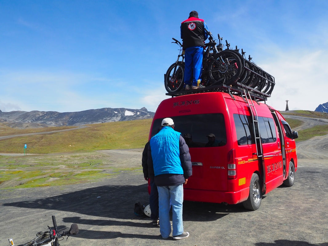 The scenery at the top was stunning, almost beautiful enough to calm the nerves slowly building in my gut. The two lunatics who would be leading our ride began throwing piles of jackets, pants, gloves, elbow guards, knee pads, shin guards and helmets out of the van. “Find your size and take one of everything” Was our instruction. As always one idiot piped up “Do we HAVE to wear all of this or is it optional?”. Needless to say, he was the first to lose skin that day. Safety aside, I didn’t hesitate and began gearing up immediately. It was around 5 degrees at La Cumbre and the wind was piercing through my clothes causing my limbs to go numb which was making riding an interesting prospect. Once we were dressed, and slightly warmer, the reality set in. We were given 15 minutes to test out our bikes, check the brakes and simply calm the nerves on the flat ground around us. 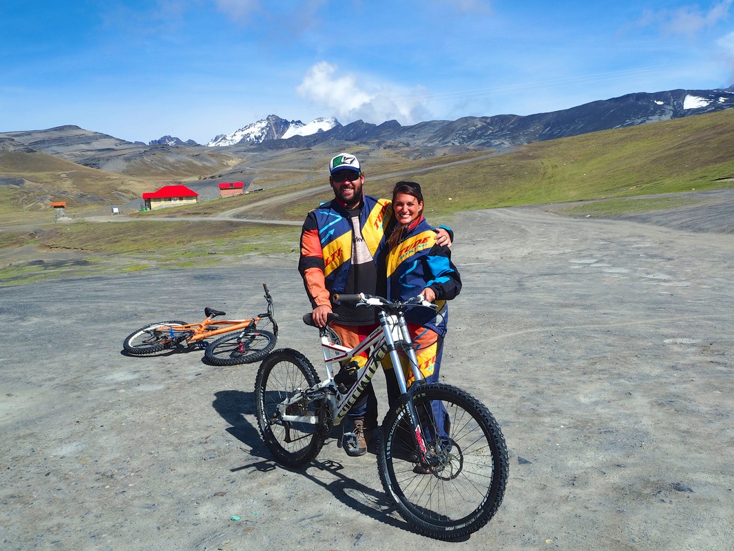 Photo: One last photo together..... Just in case! Our guides provided a brief run down of the ride and then we were off. As it turns out, the experienced guides were just as wary of our skills as we were ourselves and the starting location has been chosen not only for it’s breathtaking views but also so that riders are given a smooth introduction to the bikes. The first 20km is all downhill on a twisting, winding sealed road, complete with safety barriers and plenty of space beside the road so that the many trucks rumbling past are not interrupted by the cyclists using this road daily. Just as our speed (and confidence) increased we were stopped at none other than a Police narcotics checkpoint. Needless to say, we had all used our stash already. Heck I wasn’t getting on this bike without being high! (Joking Mum)
Photo: Well, we look the part, so I guess that counts for something, right? Here we were also instructed to go into a small, dilapidated building where we needed to pay an additional fee to ride Death Road. Apparently this goes towards the maintenance and safety upkeep costs of the road however my quip about the irony of this seemed to go unnoticed by the troll accepting payments. After a quick refreshment and final test of our brakes, we were back in the saddle. As we veered off the main road and onto a small dirt track, it was almost immediate that the valley opened up and we could either ride the track on the mountainside, or we could play with fire by riding on the cliff-side and risk a minimum 20, maximum 600 metre drop. We rode, single file, using much more of our brakes than our pedals and before long, the group had spread out as the adrenalin junkies (and that one idiot with a death wish) began flying down the bumpy slopes and around dusty corners.
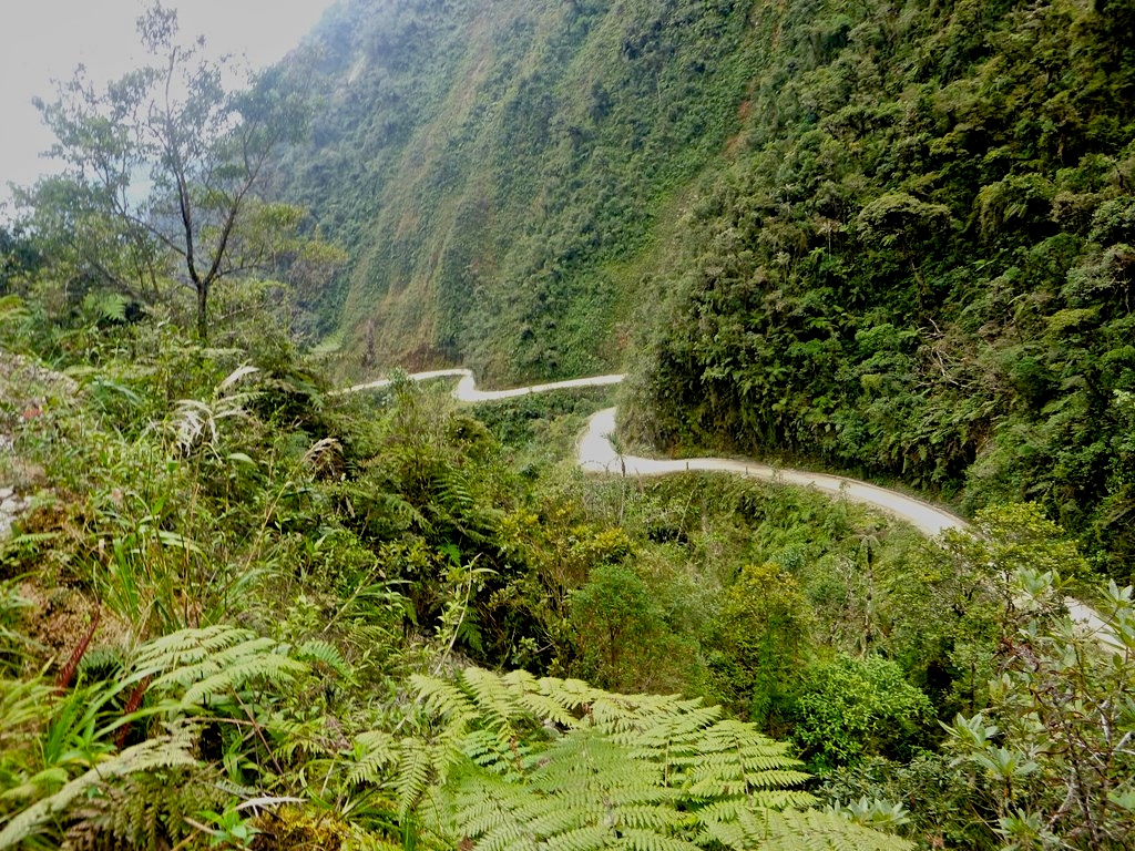
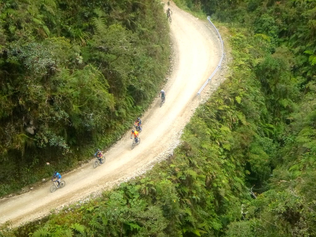
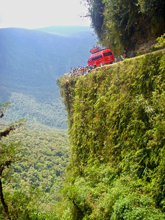
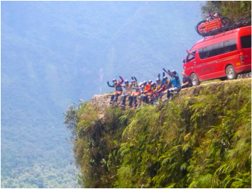
Photos: Just a few shots of the treacherous road considered the World's most dangerous. Can you believe that this was once a major route for trucks, buses and cars?? I casually cruised in the second pack as we were actually surrounded by some of the most eye-catching scenery we had seen so far in Bolivia. Ok and yeah I was quietly shitting myself every time my back tyre skidded around the deadly corners. The narrow dirt road is carved precariously into the side of a mountain with sections as narrow as 1.5 metres and sheer drops of up to 600 metres into the lush green jungle below. As much as I appreciated the view below, I didn’t want to become part of it! We cruised on through the first section passing calming, drizzling cascades on our right and seconds later, deadly precipices on our left. Wade was patiently chilling behind me secretly scared that if he took off and enjoyed the ride at a faster pace thus leaving me to ride alone, he would reach the end hours later, a widow. We regrouped after an hour of riding for a photo on one of the roads most iconic corners. Sections of this corner were so steep that we had to lie the bikes on their side so we didn’t risk a runaway bike careening over the edge while we were posing for photos! I should mention that by this point, one bike chain had snapped, one rider had thrown in the towel and boarded the minivan and one guy looked particularly dusty and his bike suddenly scratched-up without explanation. The girl in the van later informed us that as they followed slowly behind us, carefully navigating the narrow track, the driver was constantly stopping to point out a variety of cars, buses and trucks that had one way or another gone toppling over the edge of this notorious road. It was a gruesome reminder that prior to being closed to through traffic (other than local villagers or cyclists), this road took many lives during both its construction and daily use.
Photo: (Above and below right) One of the most famous sheer drops along the road. This sweeping corner has no safety guards whatsoever however on the upside, the road is almost it's widest at this point - around 4 metres wide. Just a little bit different to the nice smooth road we started on! (top right) After a few photos our guide informed us that we were not even halfway through our 64 km ride so on we pressed. I took the opportunity to reassure Wade that I had no interest in dying today and was happy to stay within my comfort zone so he should enjoy himself and go on ahead. Considering I’ve rarely seen Wade ride a bike, he took off, tearing fearlessly down the hill. I made a pathetic attempt to keep up before my weak little girly hands couldn’t maintain the strength required to hang on to my rattling handlebars over the rocky ground. Here we were staring death in the face and all I could think about was the blisters forming on my delicate palms! The most terrifying moment for me was right when the track began to smooth out a little and I was finally able to pedal rather than just squeezing my brakes for dear life. I jumped at the chance to stretch my legs out and stood up off my seat to gain some speed on what seemed to be a much safer section of road. I cruised at a decent pace around the first corner, then turned to whirr around a second blind corner, only to come face to face, in a terrified skid of dust with a small truck carrying a tray load of people! We had been told that some of the local villagers still use this road for cars and trucks however I didn’t really believe it especially after some of the narrow sections and sheer drops that we had only just managed to navigate on two wheels let alone in a truck! The close encounter shook me up and as I pulled up to our next checkpoint where half of the group was already waiting, I less–than-gracefully went to climb off my bike, only to realize my legs had turned to jelly and I somehow ended up falling to the dusty ground in an awkward embrace with my bike. I told myself no one knew it was me thanks to our matching full face helmets but barely a second had passed before Wade came running over laughing hysterically and reminding me that I was one of two females in our group so it was pretty damn obvious it was me! Damn!
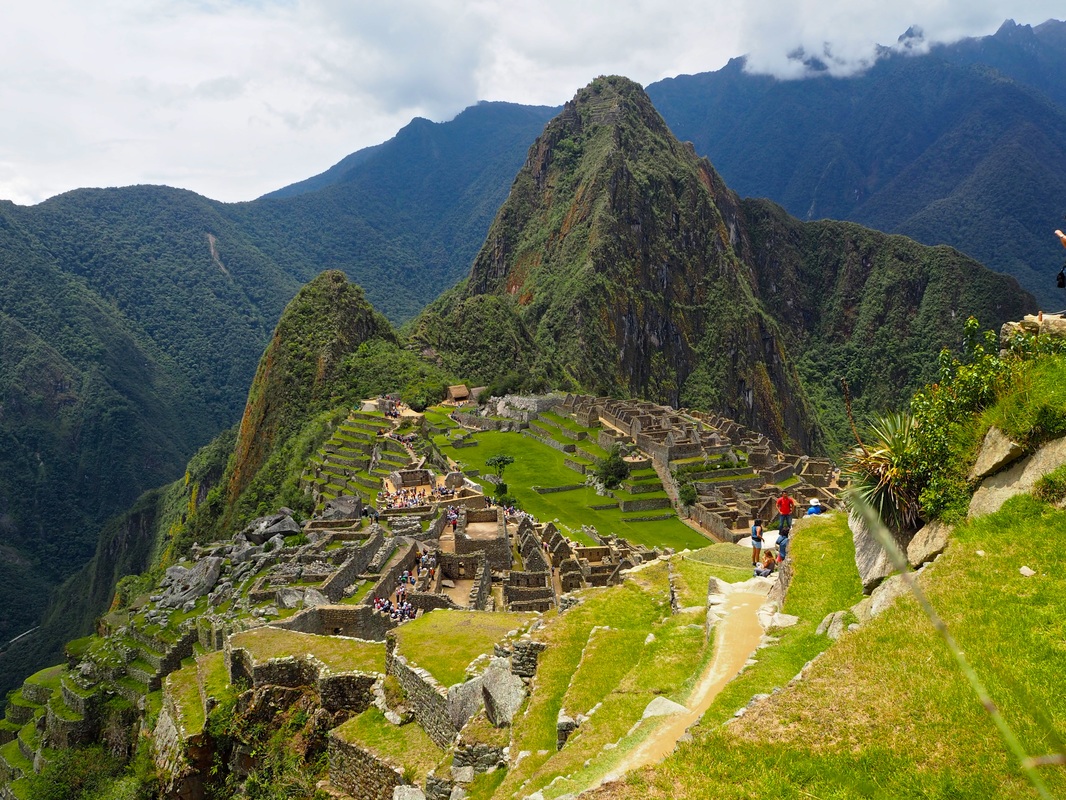
Photos: (clockwise from left) Half down, halfway to go!; Crosses along the road are a stark reminder of thee lives lost along this dangerous road; the incredible views throughout the ride Lucky for me, the aforementioned thrill seeking douche bag had experienced a brutal encounter with the road by this point and was nursing some serious bruising, a few skinless limbs and a damaged (yet still douchey) ego, so I felt much better about hugging my bike to the ground during my dismount. Just as our final riders pulled into the checkpoint, we all jumped back in the saddle for our final descent. By now, we were passing small villages and a few huts on the side of the road, reassuring us that the end was near. The road had all but flattened out and we were pedaling every few minutes now as we coasted over small rolling hills before one last death defying winding track. There are a variety of trails that riders can take through this final section once the official “Camino de la Muerte” (Death Road) is complete, however our adrenalin junkie guide chose to lead us through a series of high speed corners and steep descents resembling a vertical Olympic BMX track! Now I was blissfully unaware at the time, but later learned that Wade’s brakes had completely given up on him during this last leg of our ride. A smart man would have chosen to heed this warning and come to a smooth stop where possible, Wade on the other hand went hell for leather into the winding twists and turns using nothing but his shoes to barely survive the corners unscathed. His poor shoes on the other hand, came off even worse than the gravel-eating douche bag! By the time I saw our van waiting patiently where the dirt track ended and the comfort of a sealed road began, I breathed a sigh of relief and eagerly said goodbye to my 2-wheeled chariot of death. My entire body was in pain, not only from my first serious exercise since Machu Picchu but also thanks to the incessant vibrating as the bike had bumped, shaken and rattled it’s way down 64km of dirt road. While we started in 5-degree temperatures, we were now some 2000 metres lower in thick, humid jungle being attacked by mosquitos and sweating in our many layers of protective clothing. 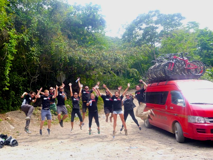 Yep. That’s right. We ALL SURVIVED which meant lunch and t-shirts all round! We all enthusiastically boarded the air-conditioned comfort of the minivan and headed to lunch. We showered, enjoyed a buffet lunch and proudly donned our wearable verification of our achievement as a “Death Road Survivor”. We were all buggered but pumped with our efforts and ready to celebrate the day with a beer or two. It wasn’t until we eventually arrived back in La Paz at sunset that we saw swathes of other tourists also disembarking minivans. Our ego’s were unceremoniously swatted down as we quickly noticed each and every one of them proudly sporting their own wearable bragging rights. Apparently more than 50 people cycle Death Road daily, making us just two more of the many survivors. On a side note, one out of every 100 is injured during the ride! And just like that, our triumph suddenly became just another day surviving travel in Bolivia! 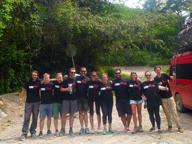 * Wade and I chose to do the Death Road Cycle through Altitude Adventures. The staff were friendly and professional and all spoke good English. Their bikes and safety equipment was in good condition and their package price also includes a CD of photos taken by the guide throughout the day. *
To find out more about Altitude Adventures, see their website here |
AuthorEnthusiastic but Useless Traveler. Archives
July 2016
Categories
All
|


 RSS Feed